TL;DR: Drove Route 66 in Arizona, hiked Sedona’s trails, explored the Vermilion Cliffs and Colorado River, kayaked Antelope Canyon, hiked to The Wave, crossed into Utah, explored Bryce Canyon and Capitol Reef National Parks, prepared to continue north

A relaxed start to our first day in Arizona quickly turned into some white-knuckled offroad driving. We were down near Hoover Dam, and the only other vehicles in sight were giant American “trucks”; basically, oversized utes. It became clear why — the steep gravel track out was unpassable to any vehicle only three days earlier. The four tonne Phoebe and her lion-heart were undeterred. So we fired up her 6.2L V8 engine and set off.
At the steepest part, it felt like Phoebe’s was almost vertical as all I could see out the windscreen was the sky! With all her 331 horsepower carefully deployed at some point, we made it through one of the sketchiest sections of road that we would travel on.
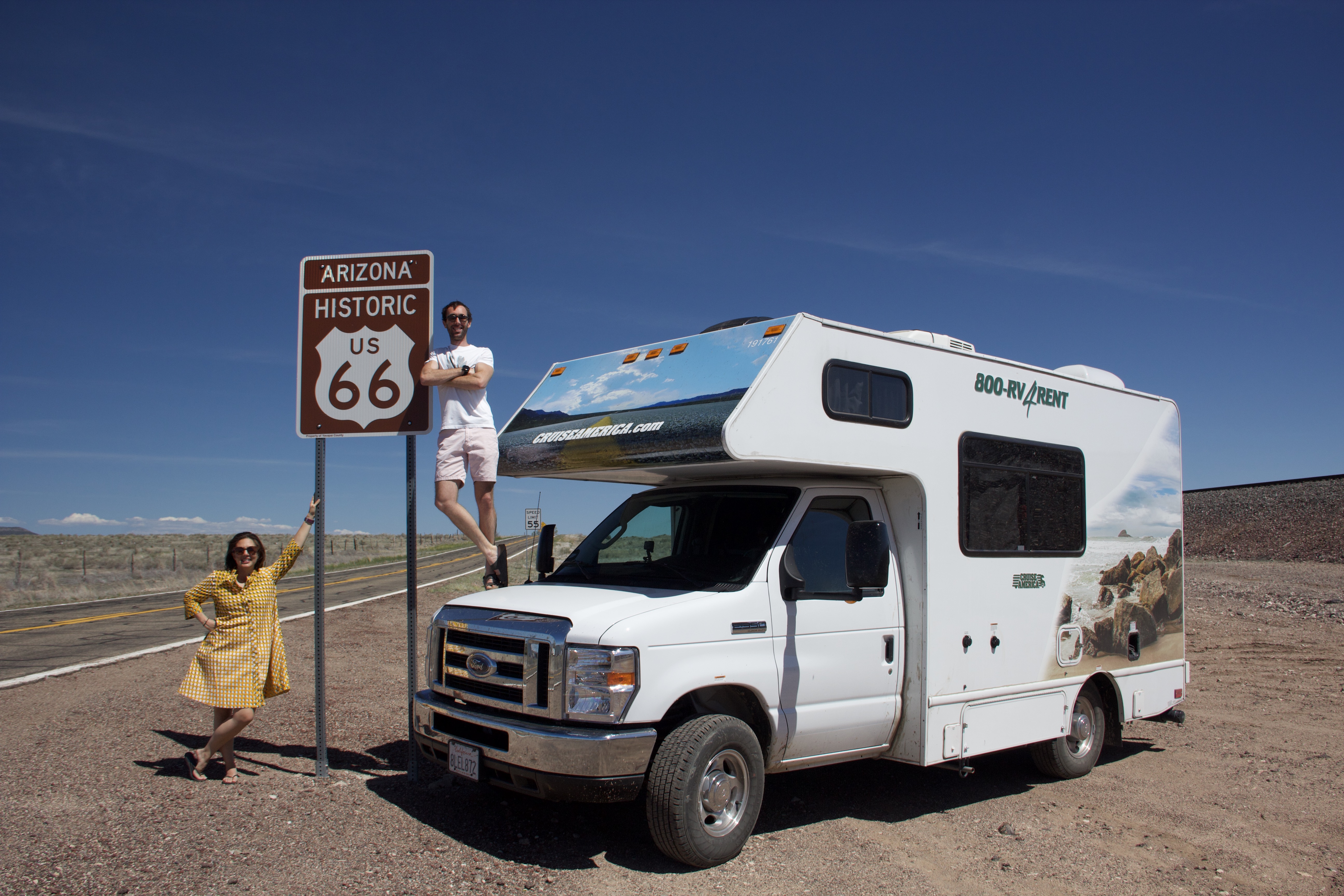
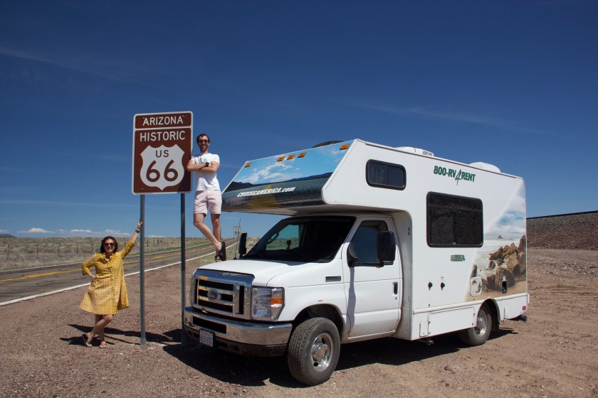
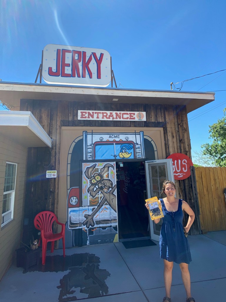
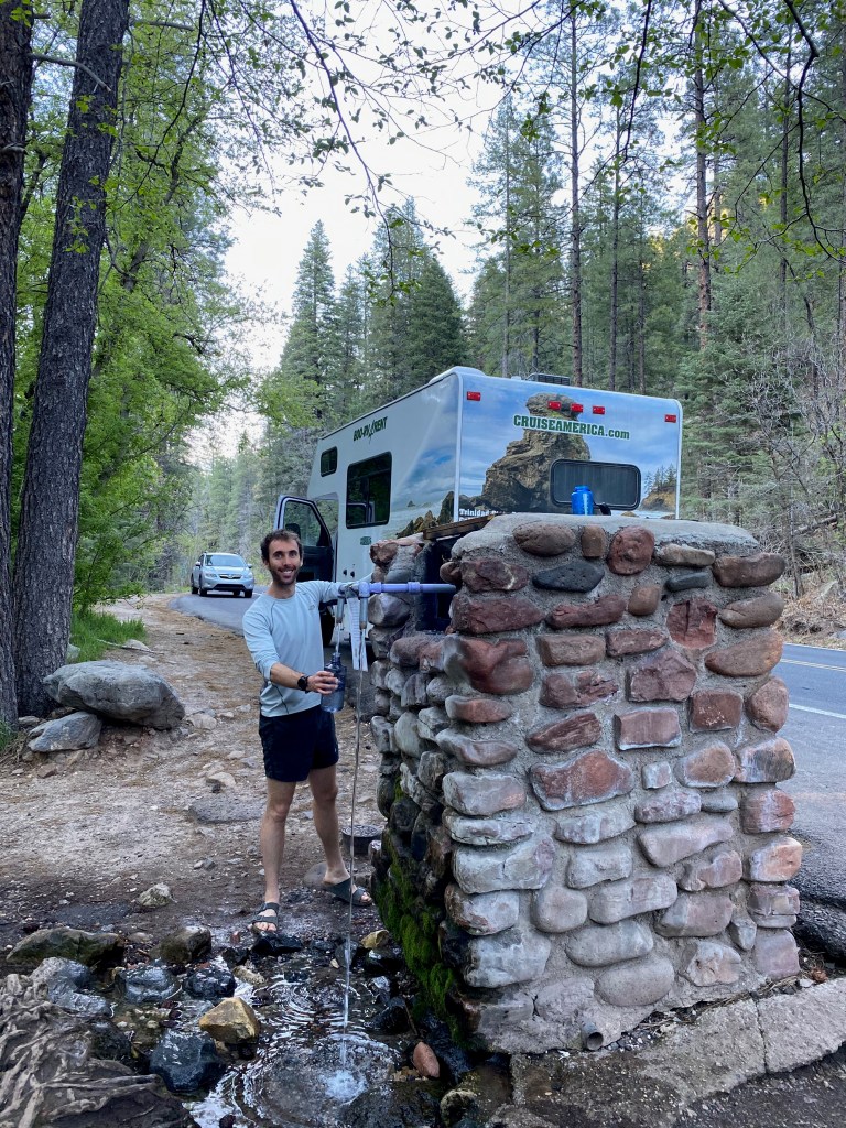
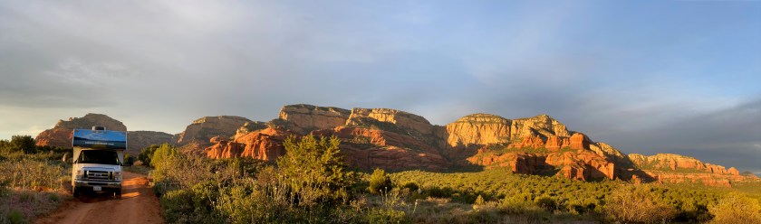
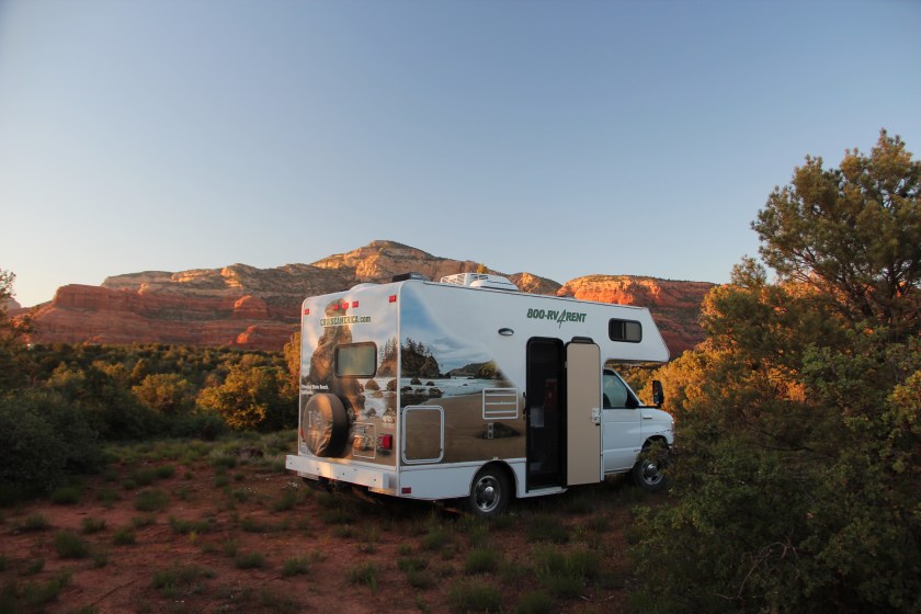
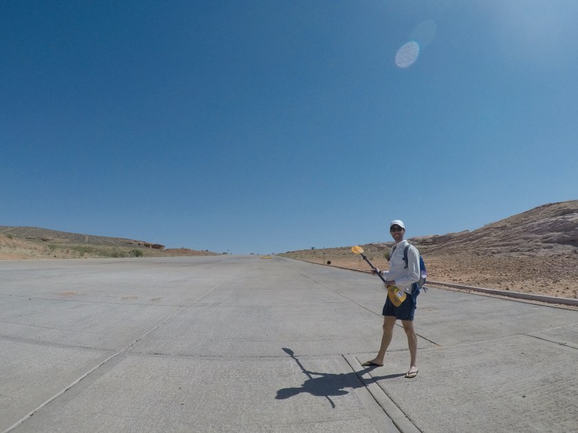
Back on tarmac, we collected our next roadside haul, some tasty beef jerky. Phoebe’s compass was then set across Arizona and towards the Mother Road, Route 66. It was a brilliant day of time-warped touring as The Rolling Stones version of Route 66 played on repeat. We certainly “got our kicks” on this ribbon of perfection as we followed America’s original road trip. En route to camp just outside Sedona we stopped at a natural water spring to refill supplies. Water was vital as next was a hot few days hiking the red sandstone formations of Sedona.
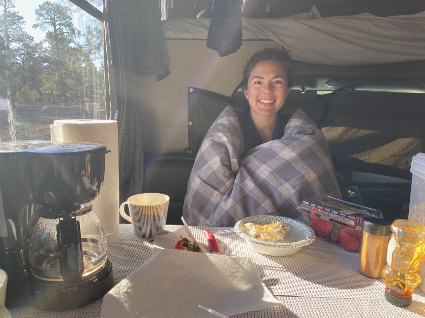
Below: Roadside jerky / Spring water / Drink and pick / Camp in Coconino Forest outside Sedona…

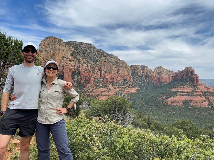
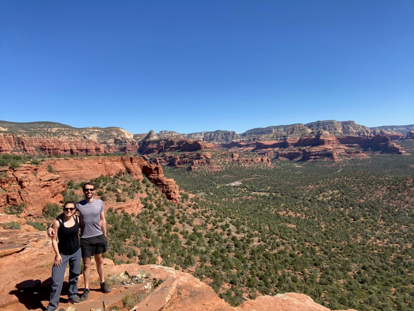
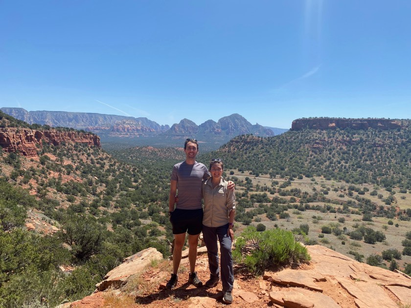
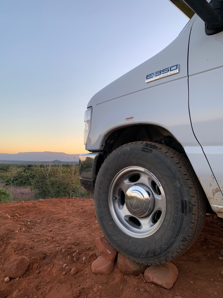
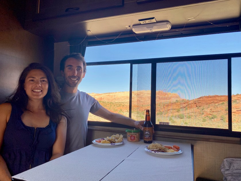
Sedona was home for the next four days we as explored the vast array of trails in the area. It was a welcome change to park Phoebe in the same spot two nights in a row, and the first time I could use the same rocks to get her level! The nightly task to find or manufacture level ground was a unique experience of The Grand Tour. By now, Sarah with her trusty spirit level in hand was a pro at finding level before we settled in at camp each night!
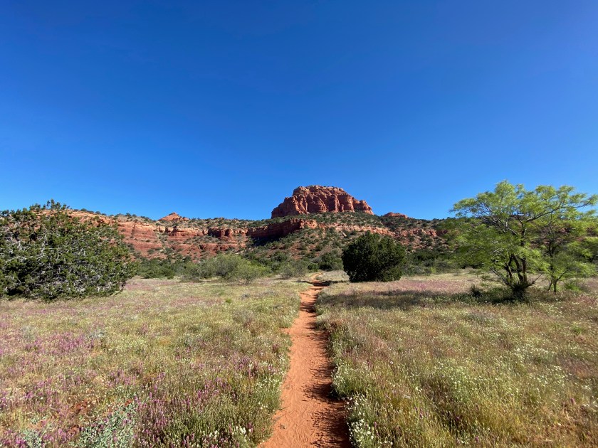
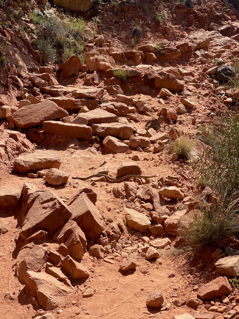
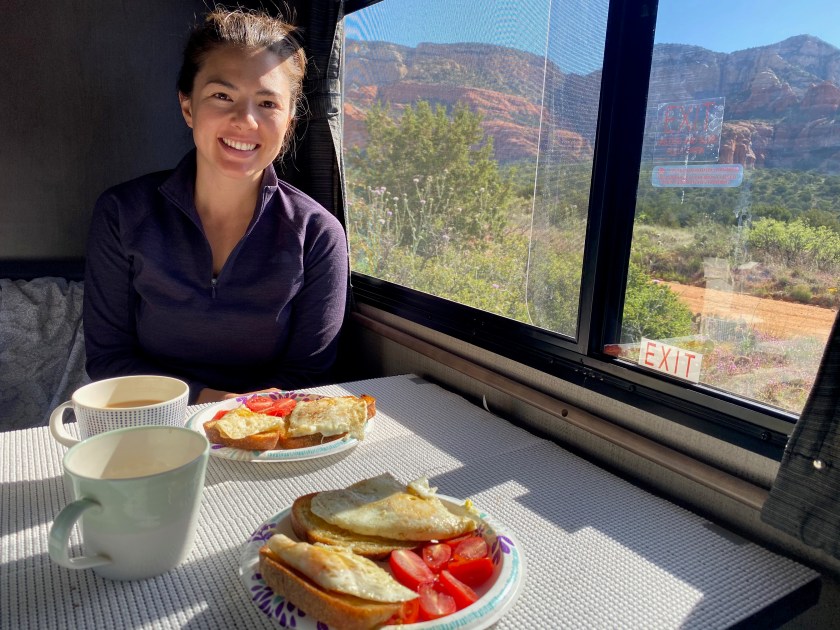
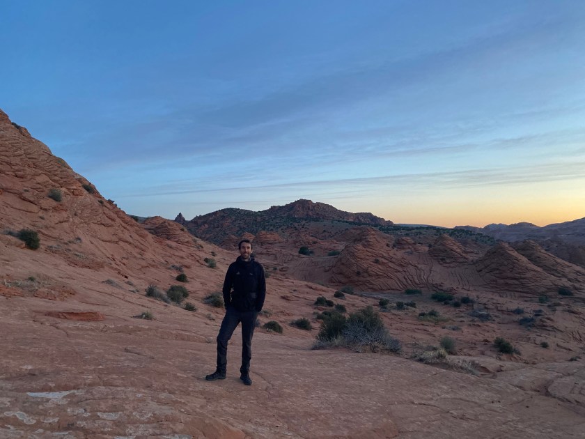
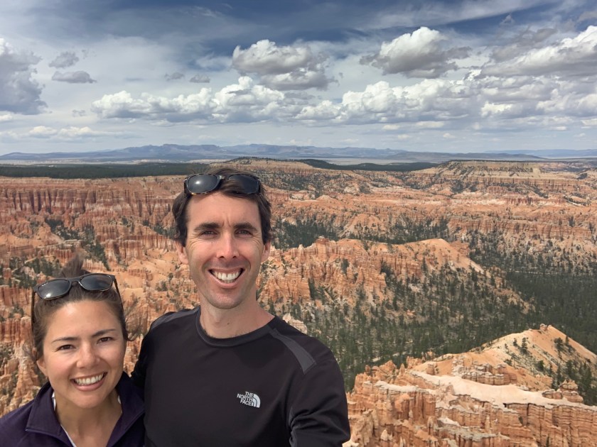
The two most popular trails in Sedona, Bell Rock and Cathedral Rock, were closed. However the dozens of other trails we just as spectacular and had almost no other hikers. The wildflower season was in full swing, which added to the beauty and also provided us with some delicious fresh wildflower honey! We averaged ~20km a day, as we explored highlights such as Soldier’s Pass, Brins Mesa Trail, Doe Mountain and Bear Mountain and sought out the highest vantage point on each trail. On our hike through Boynton Canyon, we encountered our next rattlesnake on The Grand Tour as it casually slid across the path. The views from camp each night were spectacular and allowed us to learn the correct landscape nomenclature. Who would have thought Mesa, Butte, Plateau etc. could subtlety describe different formations!? We had a fantastic time in the heat and beauty of the fiery red-rock city of Sedona.
Below: Hiking the trials of Sedona / Hello Mr Rattlesnake! / Camp level thanks to Sedona’s rocks…

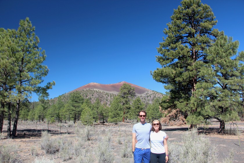
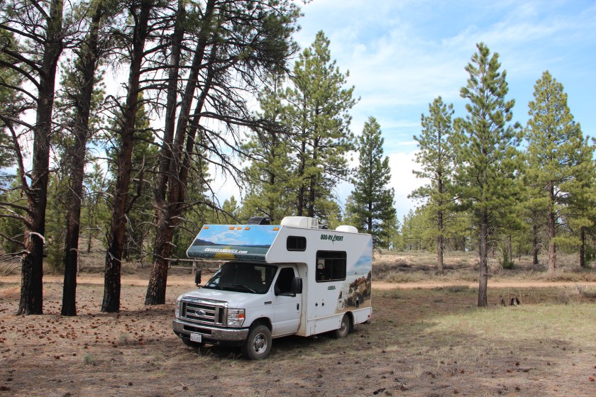
Sedona was as far east as we travelled in the Southwest States, as we got wind of rumours that Parks in Utah might be opening up, so we took a gamble and made the call to head north. Our first stop was Sunset Crater Volcano National Monument. Phoebe welcomed the opportunity to stretch her legs as we swapped the red-rocks for ash and lava flow. Camp for the night was at the base of the cinder cone. The morning provided a welcomed cooler change as we explored the youngest in a string of volcanoes, which erupted a thousand years ago.
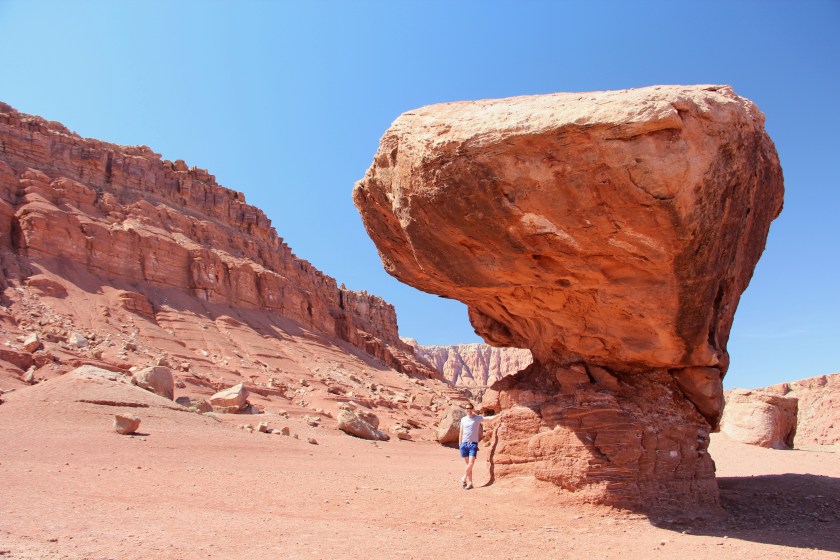
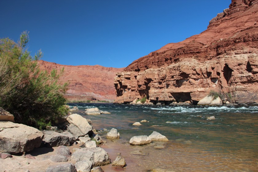
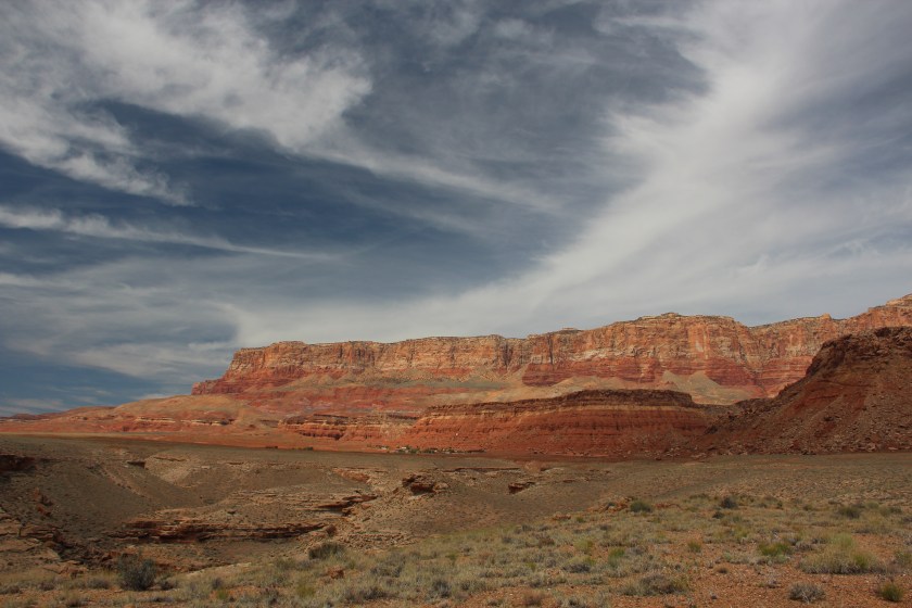
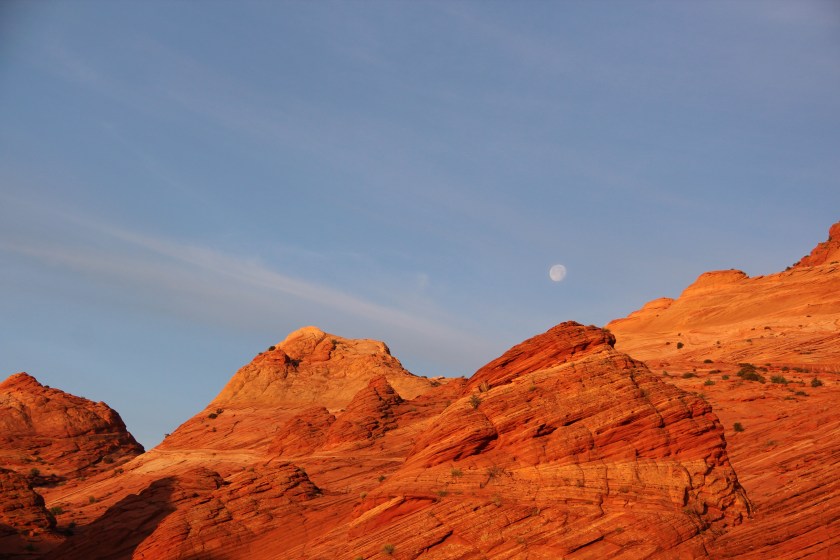
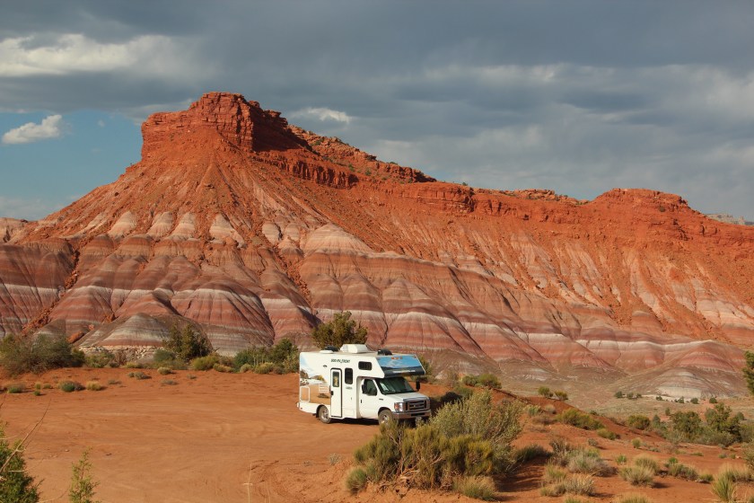
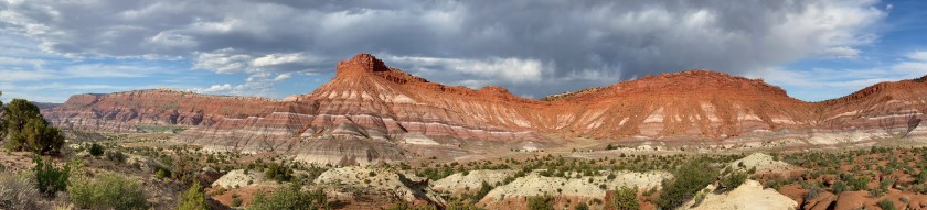
After a spot of lunch, we hit the road and skirted the outside of the Grand Canyon. Near the North Rim of the Grand Canyon, we pulled into Lees Ferry for some impromptu bouldering and an icy swim in the Colorado River. We were so close to one of the most impressive National Parks, so it was unfortunate that we were not able to explore it. However, the landscape naturally extends beyond an artificial Park borderline on a map, as we were spectacularly reminded with our camp for the night under the Vermilion Cliffs.
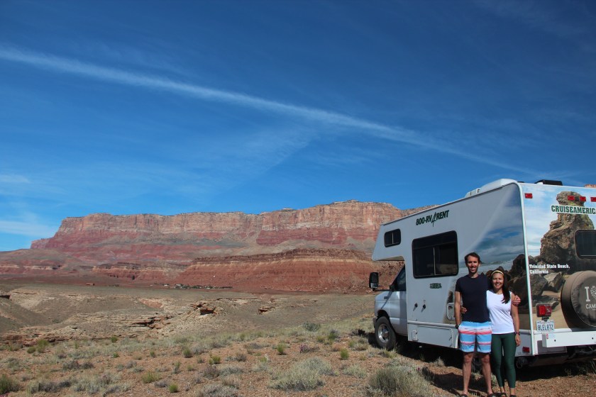
Below: Camp at Sunset Crater Volcano / Bouldering at Lees Ferry / swim in the Colorado River…

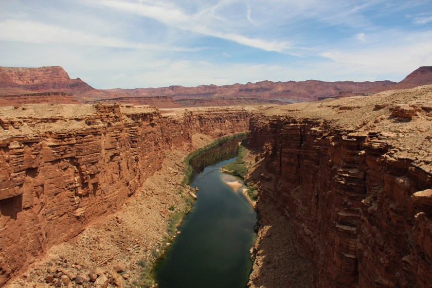
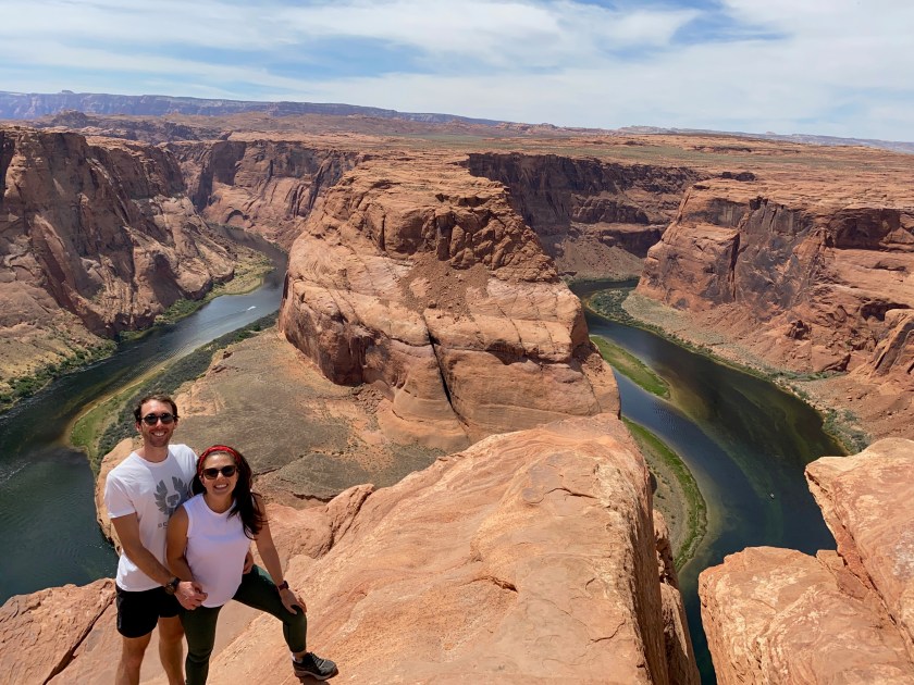
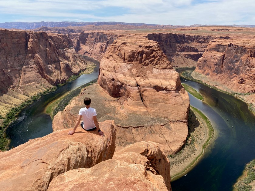
The morning light on the Vermilion Cliffs was stunning. After another photo or three, we drove north to Horseshoe Bend for lunch. We savoured more jawdropping views as the Colorado river wrapped around a stone outcrop which formed a perfect “U”. Sarah wasn’t quite as game as me to take in the view from near the edge of “Pride Rock” – a rock I named after a favourite childhood movie. After we calmed our nerves, we headed into the only form of civilisation in the area, a town called Page to restock inventory.
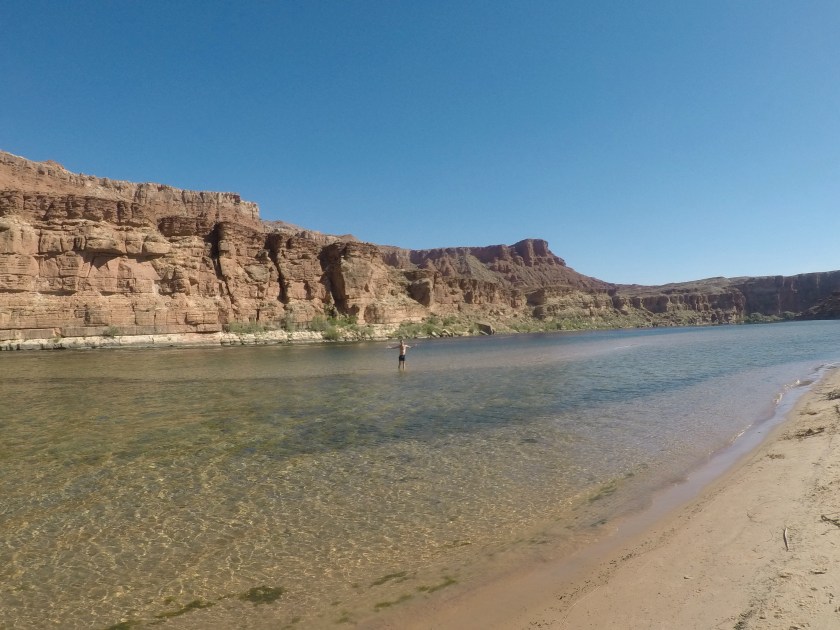
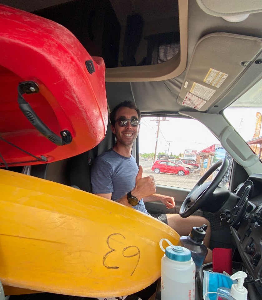
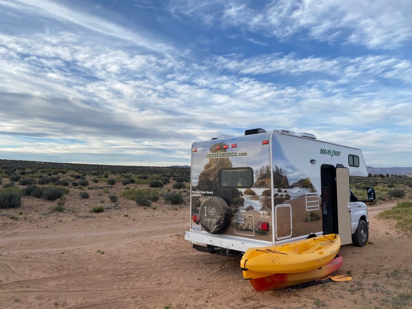
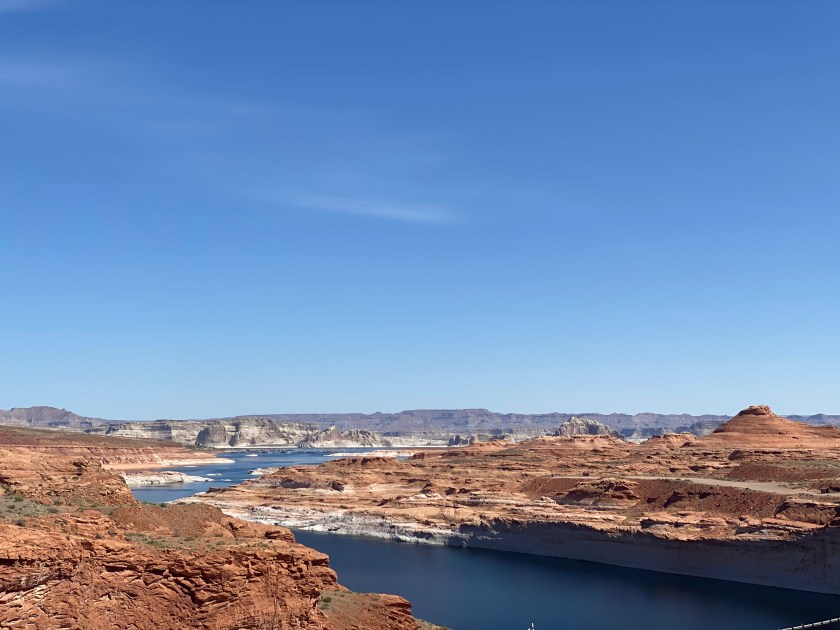
We set out to acquire a kayak to explore the nearby blue waters of Lake Powell, America’s second-largest artificial reservoir formed when the Colorado River flooded the Glen Canyon. Sarah had a brilliant plan to rent a double kayak so she could sit in the back and relax while I provided the forward propulsion. This plan hilariously unravelled when we couldn’t fit the double in Phoebe! Even two singles were a tight squeeze and a solid workout to fit in. The kayaks slept outside that night though as we made camp near Lake Powell.

Below: More Horseshoe Bend / Pride Rock / Kayaks in Phoebe / Camp near Lake Powell…
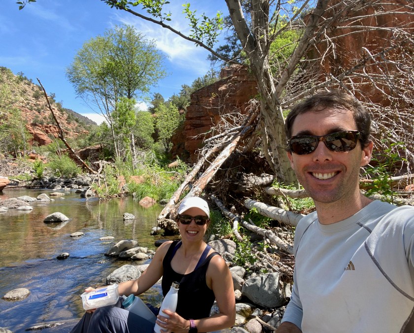
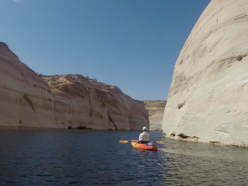
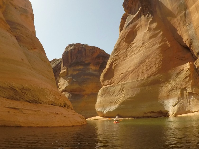
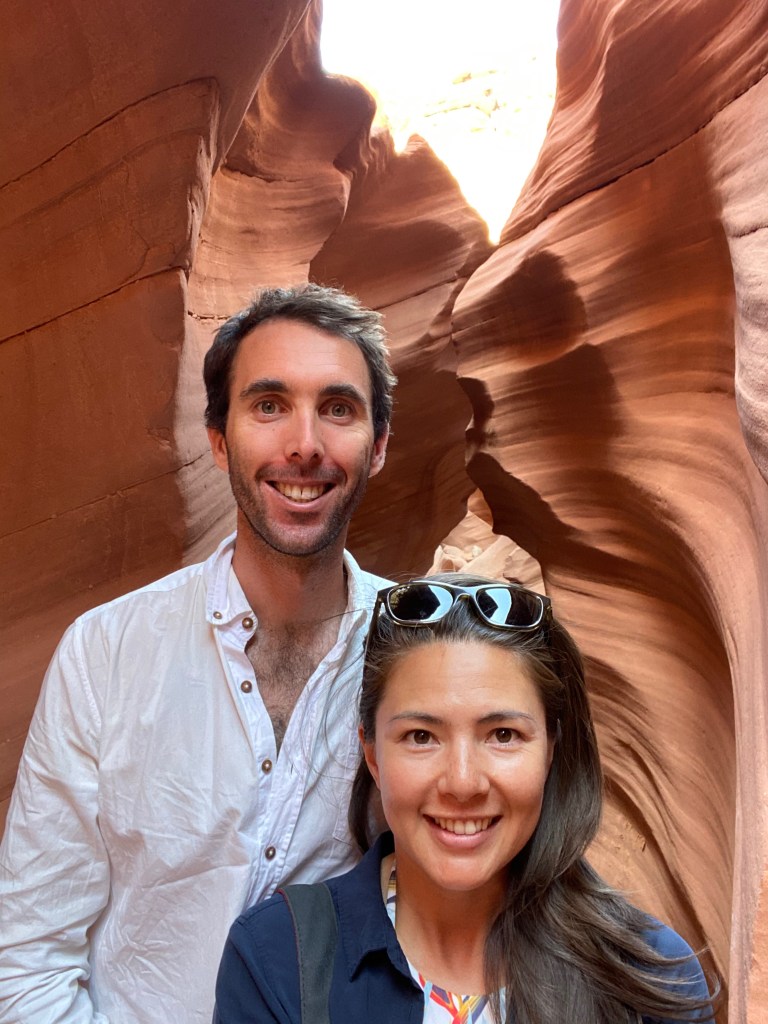
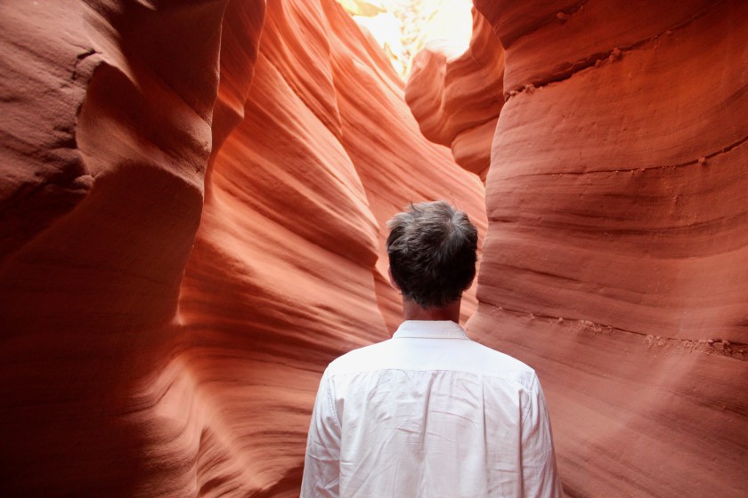
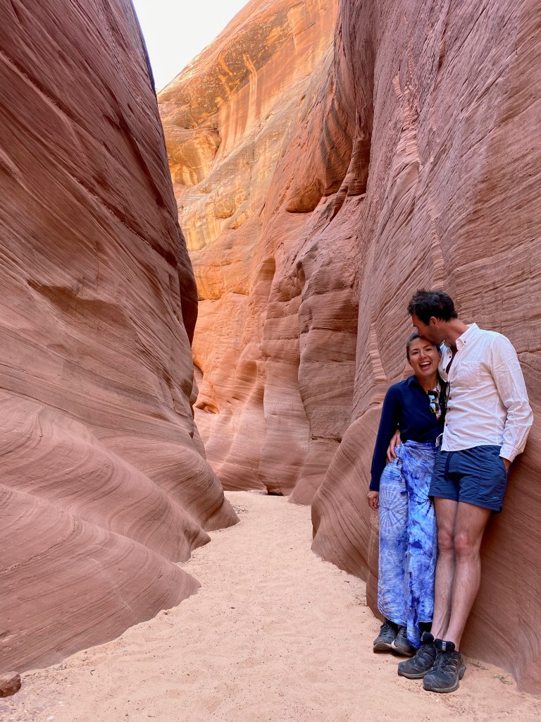
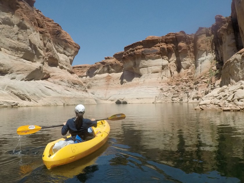
We had an early start for our paddle across part of Lake Powell to explore Antelope Canyon. Before we could enjoy the beauty of the sandstone slot canyon, we had to carry the kayaks, one at a time, down the world’s longest boat ramp. The early morning grind paid off as after solid paddle we had Antelope Canyon to ourselves! Many a “GoPro take photo” voice commands were issued as incredible structure and colours greeted us around each bend in the canyon. The water eventually subsided as we ventured further into the canyon, so we retired the paddle power and continued on foot. The walls formed by the erosion of the sandstone by rainwater were incredible. Sarah did a fantastic job to capture the flowing shapes while I just did my best not to ruin the photos.
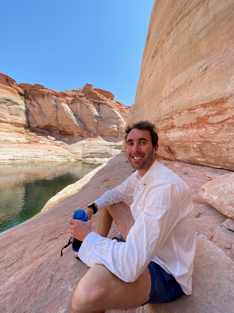
After a brilliant morning in the corridors of Antelope Canyon, we had one of our most scenic picnic lunches on The Grand Tour so far. Refreshed after a swim, we prepared for the paddle back. The paddle became sketchy very quickly as what I assume was Lake Powell’s equivalent of the Fremantle Doctor (a stiff afternoon sea breeze for those not familiar with this West Australian legend) picked up. We had to paddle right into the teeth of it, and half the time I couldn’t work out if Sarah gained or lost ground which provided much comedic entertainment. After we dug deep and my offer of a tow was stubbornly refused, the boat ramp came into sight. We reached the safety of land and lugged both kayaks back up the never-ending boat ramp, returned the gear and relaxed over a well-earned beer after an incredible day of adventure.
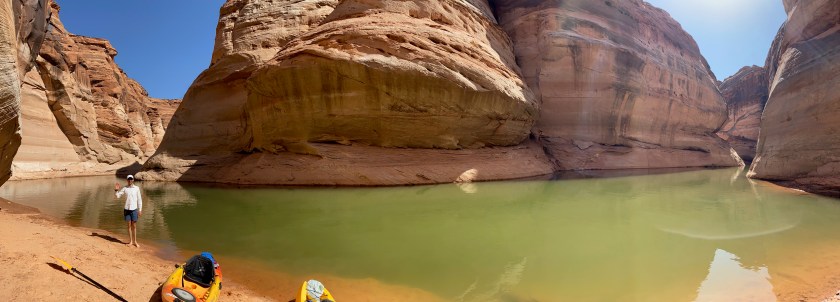
Below: Antelope Canyon by water and by foot / World’s longest boat ramp…


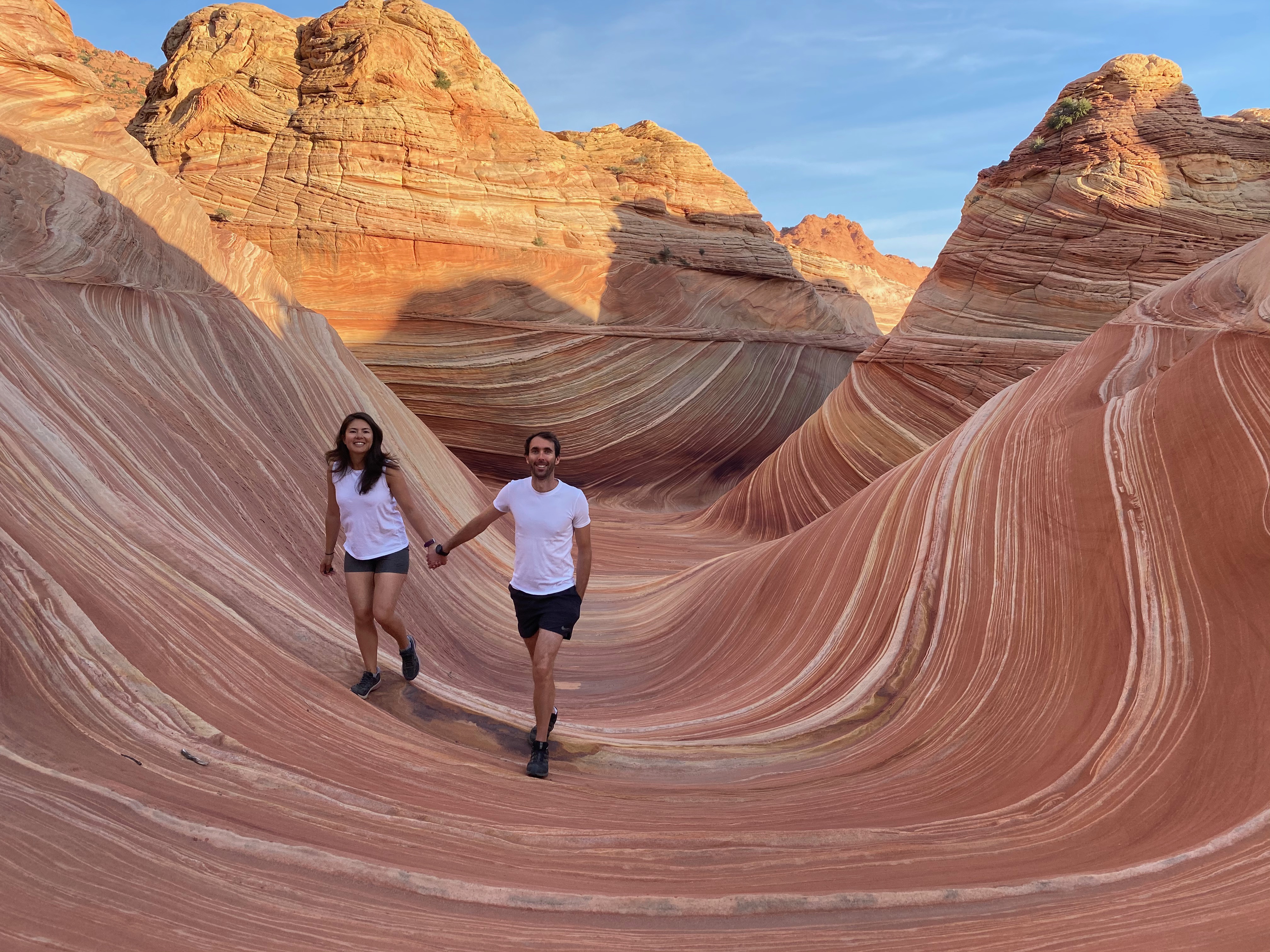
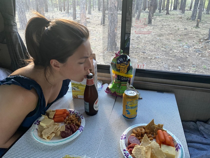
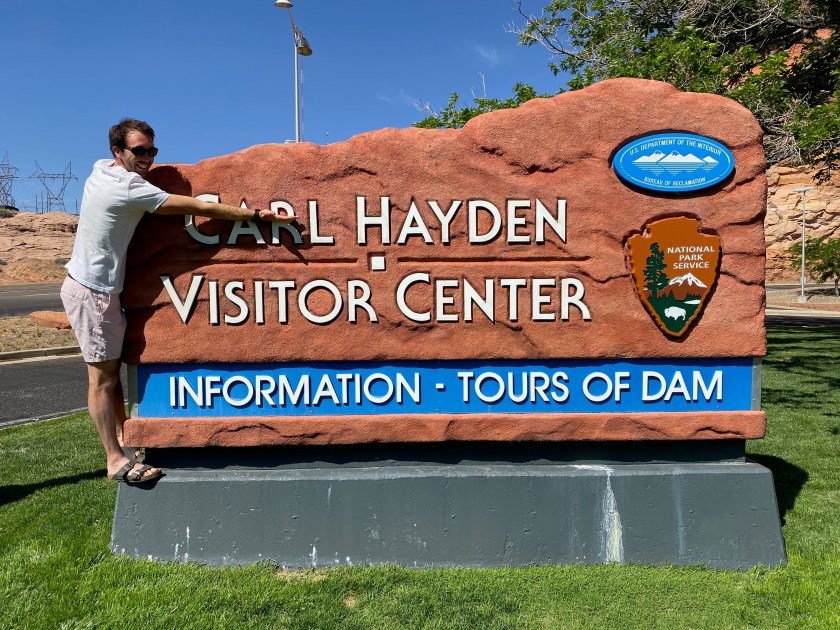
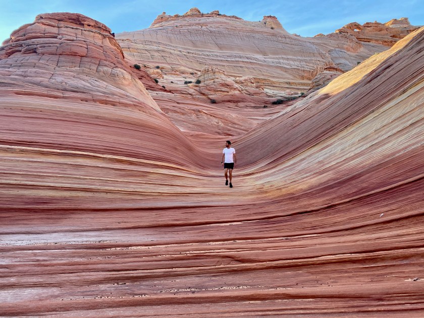
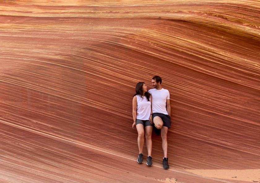
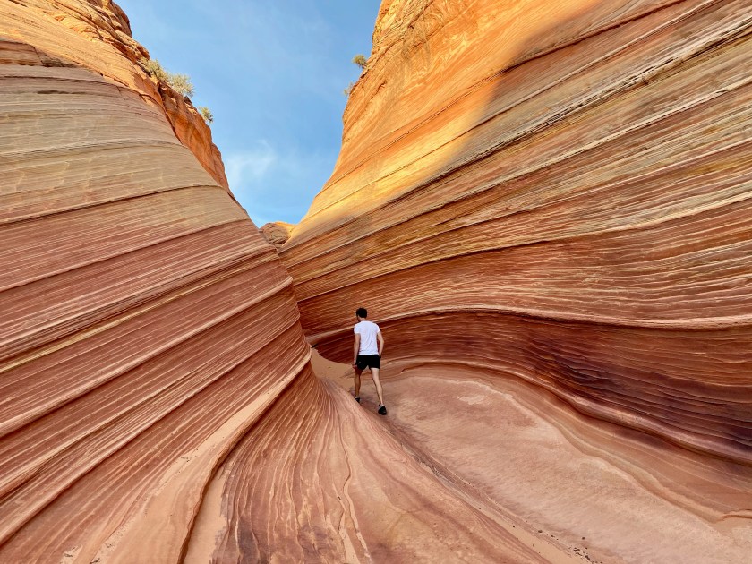
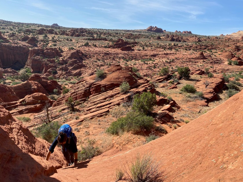
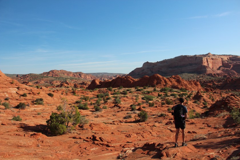
In the morning, we explored more of the rock formations and sharply cut canyons of Lake Powell, which included the Carl Hayden Visitor Center (big fan of what Karl and I have done with the place). The afternoon turned into more an adventure than planned. If Phoebe’s past offroad adventures were more of a sprint, then the road into camp was a marathon! We endured two hours of gravel, rock, dust and consistent washboard ruts. The reward for our efforts was worth it, as we could start our hike into an incredible sandstone rock formation called “The Wave” early the next morning. We perched Phoebe up on a hill and packed our gear for the adventure through the Coyote Buttes Wilderness.
With full backpacks and headlights on, we set off very early with only the moon to provide some additional light. The ~10km hike to The Wave was incredible, but the destination was something else. The Jurassic age sandstone troughs carved through water runoff and wind were spectacular. The formations captured a different piece of the morning light from every angle possible. Sarah and I were incredibly fortunate and grateful to be able to experience the natural beauty of The Wave. We left only footprints and took only photos as we “waved” farewell and started the hike back.
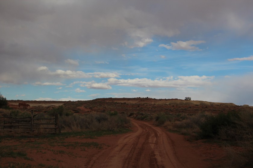
Rather than retrace our footsteps, I thought it would be much more fun to explore a different route back to Phoebe with an off-piste hike. With only the blazing sun to help navigate and a “she’ll be right” attitude, we started our way back. I guided Sarah up several steep scrambles and one dead-end route due to a sheer drop into a canyon. These slight miscalculations resulted in the unceremonious end of my chief navigation officer duties. Instead, we resorted to the trusty blue dot on the AllTrails app to guide us back to Phoebe. Safely back, we drove out the same rutted, dusty gravel road and crossed into Utah. Just over the border we made camp in the Paria Badlands and relaxed after a magical day of adventure.

Below: Top-notch visitor center / drink and pick at camp / Out-and-back hike to The Wave…


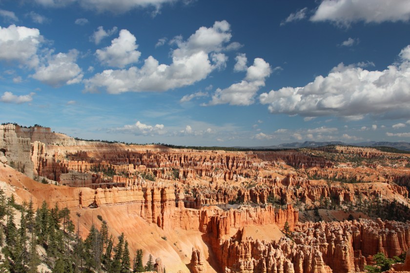
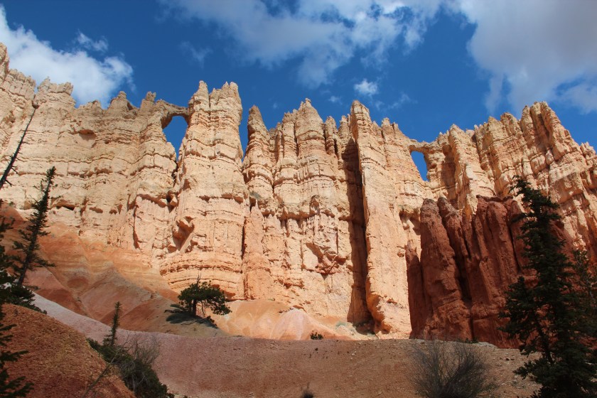
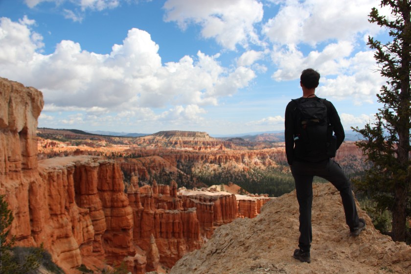
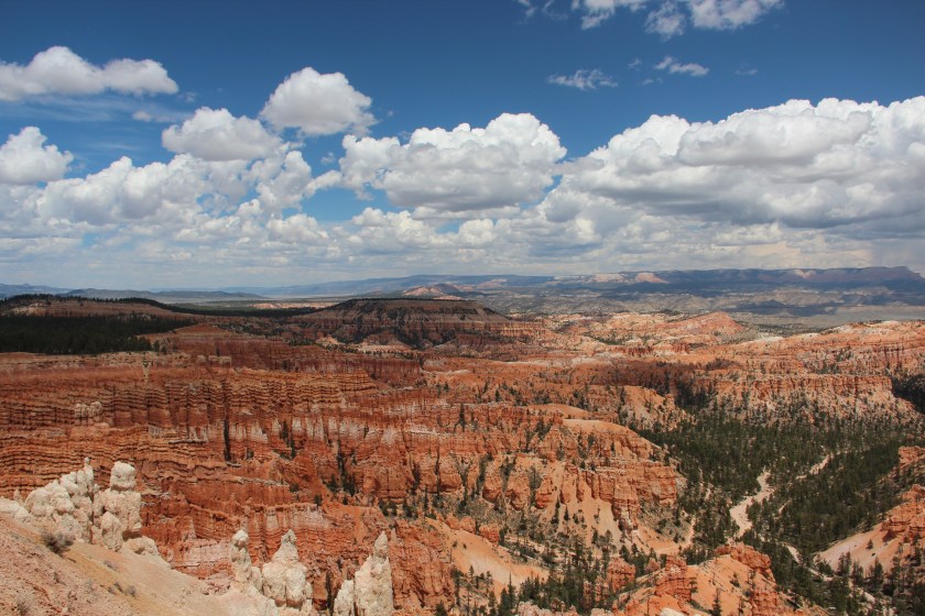
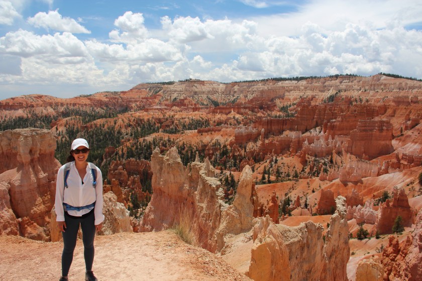
Well rested, we left the colourful rock layers of the Badlands and headed towards camp at the next National Park on The Grand Tour, Bryce Canyon. Not to be misled, the Park is not a “canyon”, rather a spectacular amphitheatre eroded from the plateau cliffs. We made camp, relaxed and researched the trails for the adventure ahead. The next day we hiked the steep Amphitheater round loop, which weaved through brilliantly-coloured pinnacles and points, steeples and spires and totem-pole-shaped “hoodoos”. It was special to experience a landscape that originated over 60 million years ago, brought to life with warm shades of reds, oranges, pinks, yellows and creams from the eroded sedimentary rocks. After we attempted too many panorama photos to capture the stunning formations of the plateau, we returned to camp outside the Park.

Below: Camp in the Paria Badlands / Adventures in Bryce Canyon…


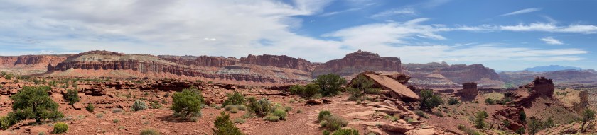
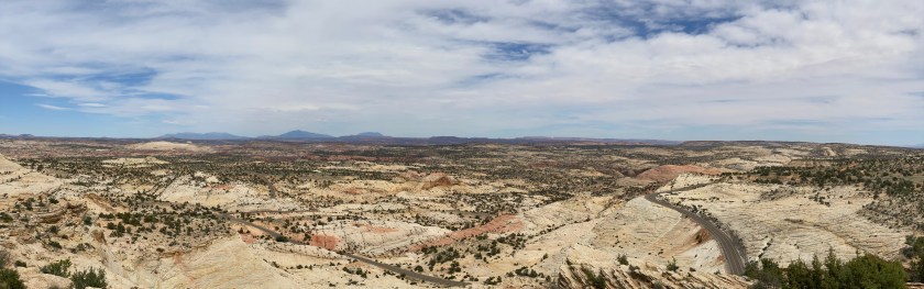
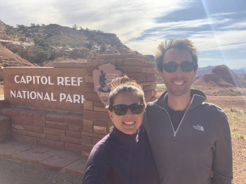
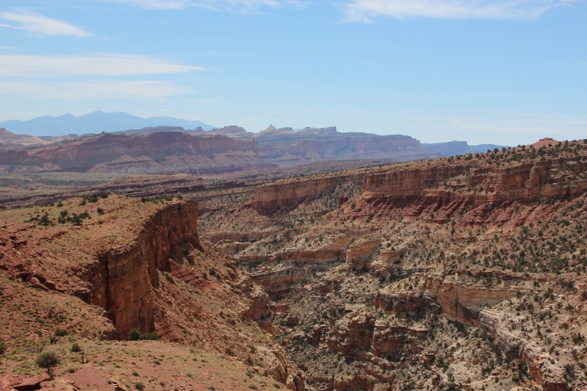
We enjoyed breakfast and one last spin through Bryce Canyon National Park and then aimed Phoebe towards our third National Park of the Grand Tour, Capitol Reef. A highlight of the day was a fantastic drive through The Grand Staircase-Escalante National Monument. After we completed the journey through this remote, vast land without a hint of civilisation in sight, we understood why the area was last to be mapped in the contiguous United States! We settled into camp and our daily ritual of a high-quality drink and pick just outside Capitol Reef National Park.
The Park is a 100-mile long monocline created 65 million years ago when sedimentary rock buckled. The ridge was a formidable barrier to ground transportation, so it derived the same name as an ocean “reef”. We explored the spectacular cliffs and rock formations in the morning. Remnants of human history in the area allowed us to “time travel” in the afternoon. First, it was the petroglyphs of the prehistoric Fremont people, followed by old structures built by Mormon pioneers. Back in the present day and with the benefit of an internal combustion engine, we continued north to Goblin Valley State Park and camp for the night.
Below: The Grand Staircase-Escalante National Monument / Capitol Reef / Camp outside Goblin Valley…


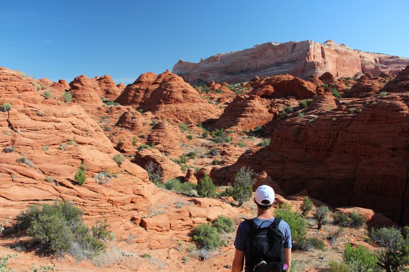
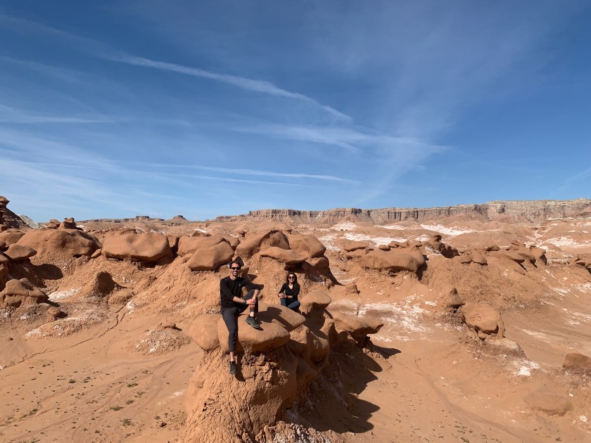
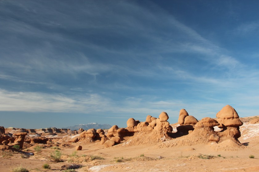
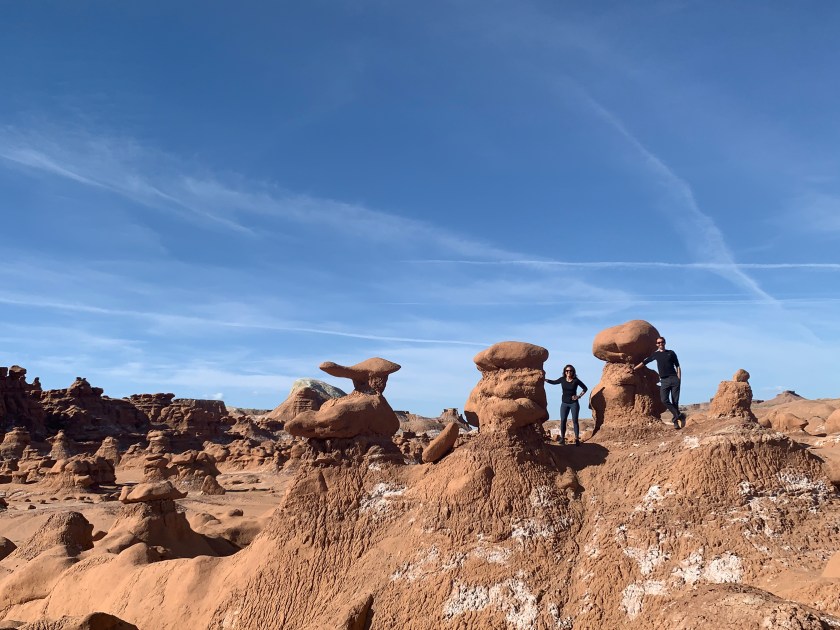
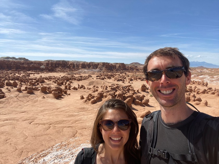
We explored the thousands of hoodoos, referred locally as goblins, in the morning. They are mushroom-shaped rock pinnacles formed by an erosion-resistant layer of rock atop softer sandstone. If we weren’t amid a global pandemic, Canyonlands and Arches National Parks would have been our next destinations. Unfortunately, both were still closed. In these uncertain times, I reminded myself of a quote from one of my favourite stoics Marcus Aurelius — “why should we feel anger at the world? As if the world would notice”.
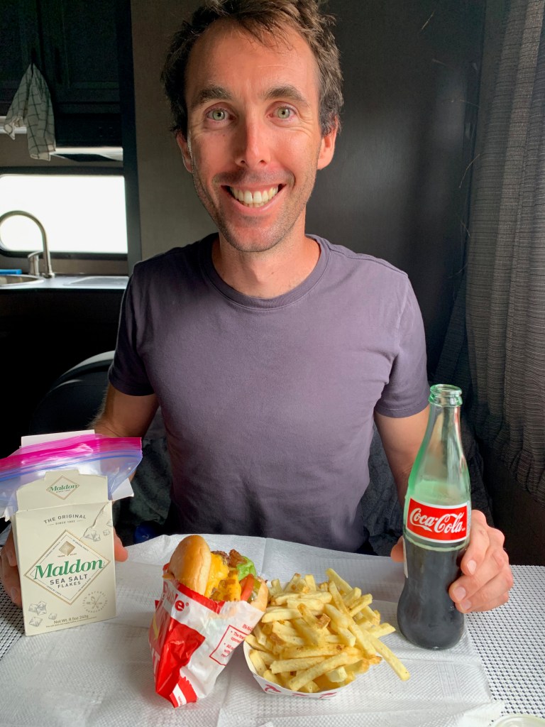
With everything going on in the world, Sarah and I knew we needed to remain agile on The Grand Tour. So when Wyoming announced they were to open up their Parks — we chartered a new course to explore Yellowstone and Grand Teton National Parks earlier than planned. We needed to restock inventory before going off the grid again, so headed into Salt Lake City. With life admin done, which included our first big wash of clothes (25 days into The Grand Tour – it was due!), a reward was in order. We chose a classic American burger, the first outside meal we had on The Grand Tour. Post food coma, we headed north towards a National Park we were both excited to visit for a very long time, Yellowstone!
Below: Goblin Valley / In-N-Out Burger…


Wyoming is where we will pick up our adventures (including some encounters with grizzly bears!) in the next blog post…
We hope you and yours continue to be safe and sound.
